Porous City - North District Masterplan
Location : Tainan City , Taiwan
Principal work : Urban Planning, Urban Design
Plan & Design period : Oct 2016 - Feb 2017, team project
Mentor : Horng-Chang Hsieh
Contribution: Site Analysis / Architecture Design / 3D Modeling / Presentatio
Location : Tainan City , Taiwan
Principal work : Urban Planning, Urban Design
Plan & Design period : Oct 2016 - Feb 2017, team project
Mentor : Horng-Chang Hsieh
Contribution: Site Analysis / Architecture Design / 3D Modeling / Presentatio
PLAN TOPIC
This project propose a new master plan for north district, from the site selection, analysis, and planning issue, finally, we propose the planning strategy and the land use zoning control principle. This operation trains our large-scale planning and analysis capabilities, which are mainly divided into the following three operational priorities:
- In response to the trend of declining population and population structure in the northern part of Tainan, the development of the planning area was re-examined in light of the natural environment and traffic location conditions.
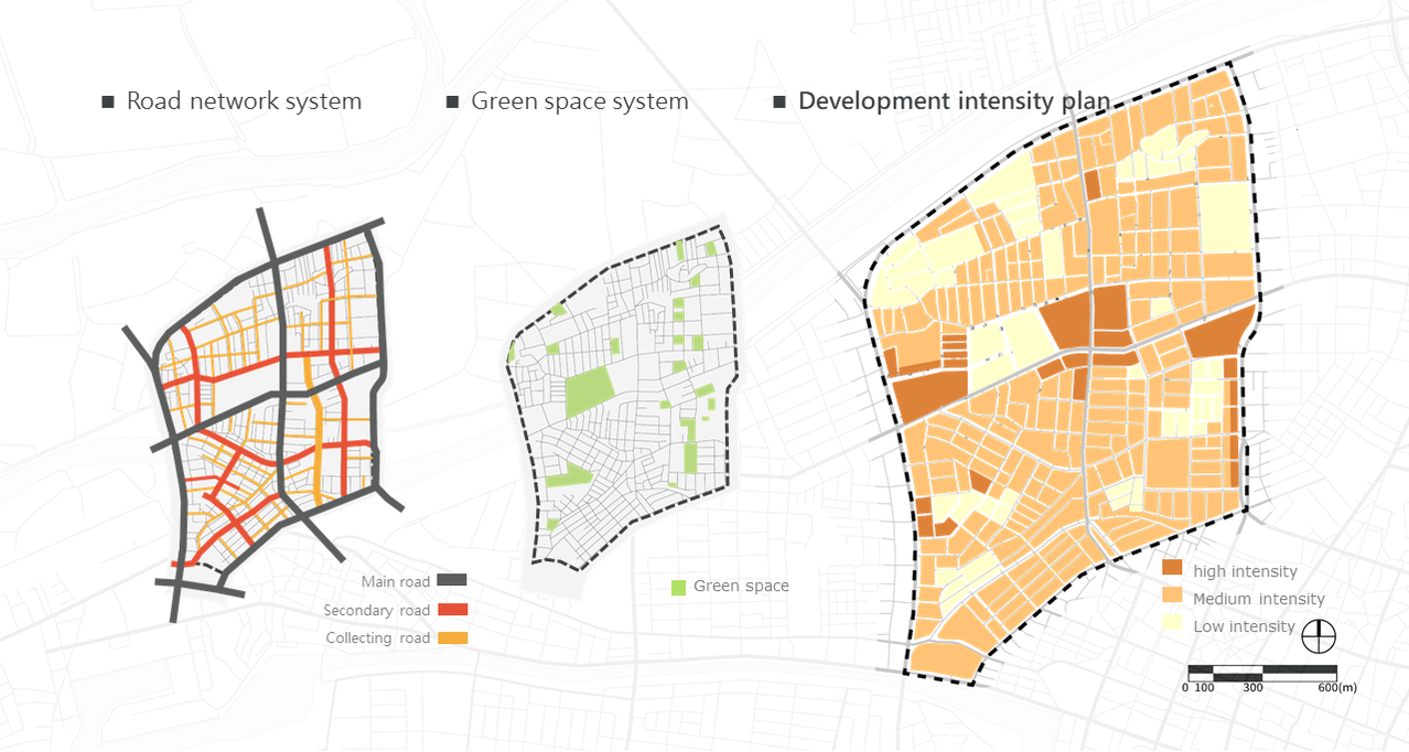
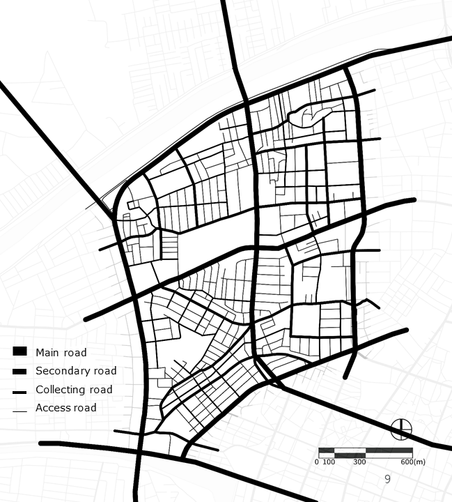
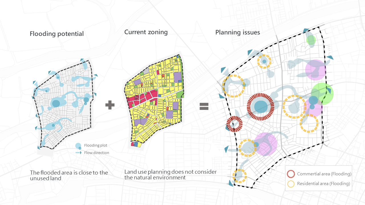
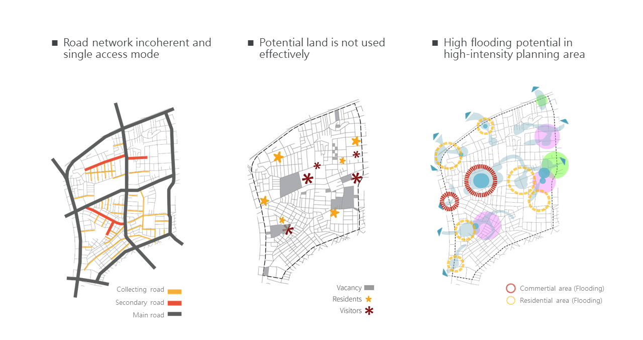
- Due to the growing urban suburbs, the roads within the base are no longer sufficient to serve the increasing number of trips between cities and suburbs. In order to avoid worsening traffic conditions, the road network system in the project area will be redeployed, and the land use intensity will be reduced according to the flooding potential.
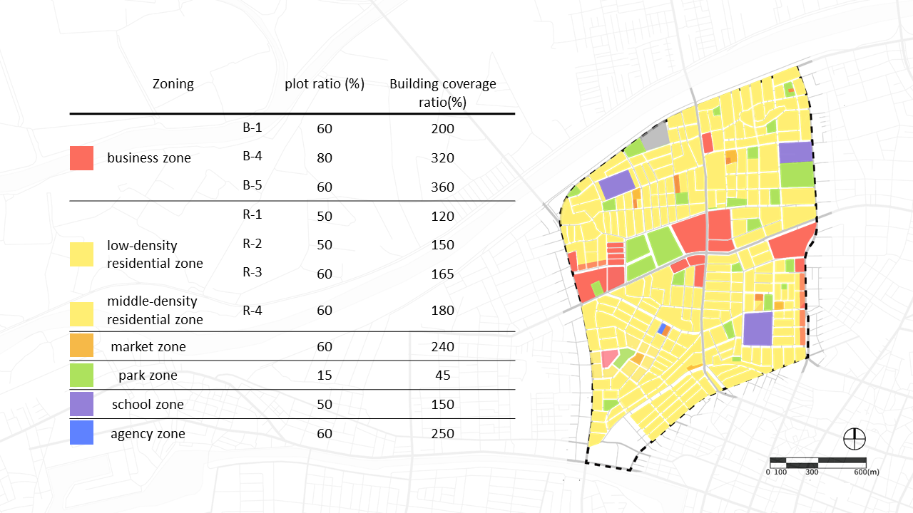
- In response to the phenomenon of declining birthrate, re-examine the use of public facilities in the site. Release some undeveloped school space into residential, park and road to provide local living needs.
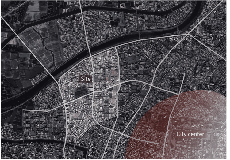
SITE SELECTION
The location of the urban edge is unique. It is not only cut by the outreach road and population loss, but also has a large internal block so that the daily activities of the residents are restricted. In addition, such a site location has the function of urban and rural coordination. In the global climate change environment, the characteristics of the urban edge can be used to regulate urban flooding. Therefore, we chose this area as the site for this work.
CURRENT STATUS OF SITE
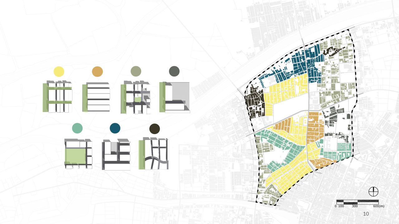
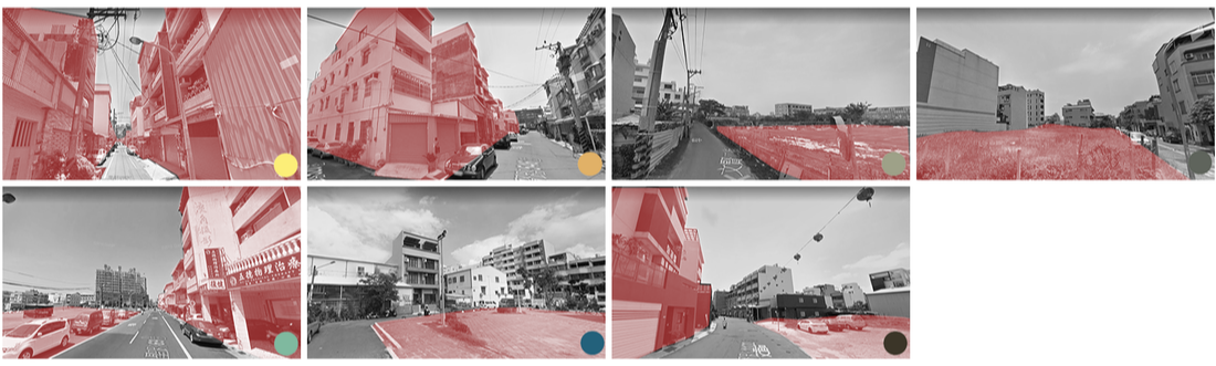
We draw figure-ground and the road network structure diagram, observe the characteristics of the built environment of the site and the flow pattern of the circulation, and further divide it into seven types of street block according to the actual virtual space and the current situation of the built environment. These seven types of street block will serve as a reference for base analysis and planning issues.

|
|
SITE ANALYSIS
Based on the understanding of the current situation of the site, we determine the direction and target of the planning, and further analyze the site. The contents are as follows:
PLANNING ISSUES
- The collection roads and secondary roads within the site is inconsistent and therefore inefficient to use, so that most of the residents use the main roads that pass through, causing the main road traffic to exceed the load, reducing its efficiency and safety.
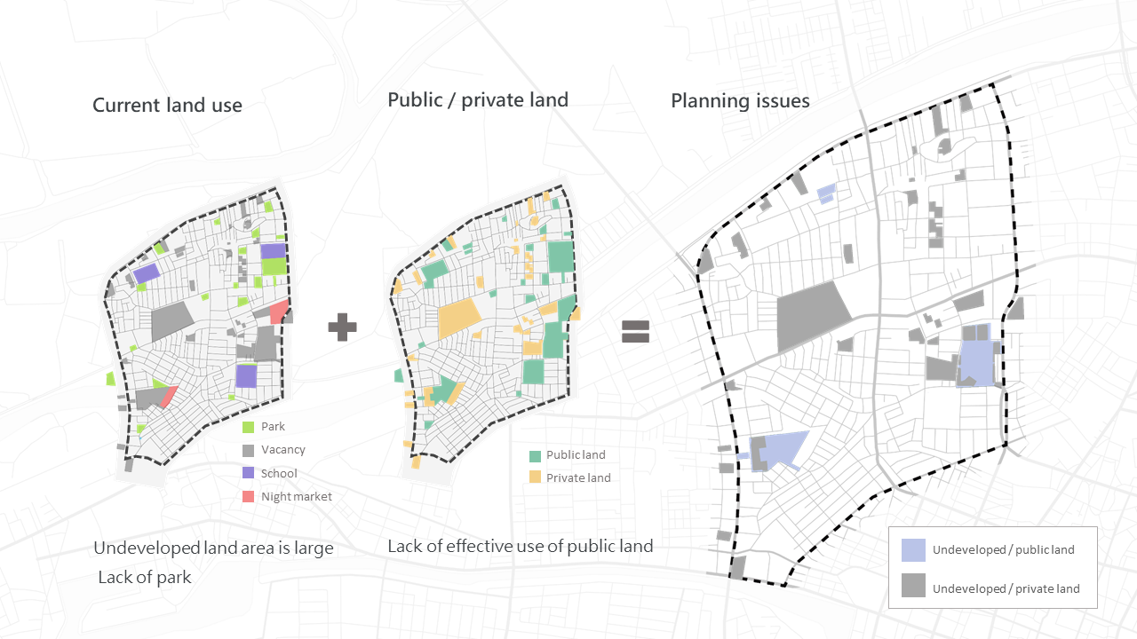
- Large areas of unused land in the site should be planned for tourists, residents or nature according to their location characteristics, to avoid becoming a unwanted space.
- In some areas of the base, the area is affected by flooding. The overall planning should be based on the flow of land. It will not only provide local residents to use the park, but also serve as a land for urban flood control.
SUBSTANTIAL PLANNING